Monday, November 1, 2010
dirty coast compass rose
Just a word on navigation, (and i know i'm a million years late on this) dirty coast has a tee shirt for sale with a singular "new orleanian" compass rose overlaid on the map of the wards. Instead of North, South, East, West, the rose displays "Lake, River, Downtown, Uptown."
the only problem i have with it-- how are you supposed to look at the shirt when you need to find your way? maybe i can get it printed upside down, and grow a beer gut. you know, for navigation purposes.
scptt
Friday, October 29, 2010
CRITICAL MASQUE Cemetery Ride To-NITE! 6pm Jackson Square
the dead drive the streets, burning fossil plants on their blind way.
encased in steel, they no longer feel the sun, no longer do they feel the bump of the earth and the contour of the land,
no longer do they hear the wind or see their fellows teeming in the hundreds beside them
the dead drive and drive to and fro in cattle lines, unsullied by the heat of the sun or damp of the chill air
the dead hand of greed drives us into war for oil and toil for a scorched earth,
the dead drive the state and the nation into the sea, which rises into the heated air to swallow us
for what do the dead fear? The dead cannot drown.
but we the living ride, masked to cheer the dead hands that drive our lives, to call them forth to all hallow’s eve.
Let’s Ride Bikes! Critical Masque Cemetery Ride TONITE! 6pm Jackson Square
A tour of the cities of the dead, in a city not long for this world
http://www.nolacemeteries.com/
15 miles, 3 hours. now dressed!
Tuesday, September 28, 2010
Bike Ride to Delacroix
A bike ride to delacroix on a sunday football weekend. People thought they couldn't do it, people thought i was crazy, several people backed out, or only wanted to do half. I'm sorry that nothing was decided beforehand, but planning takes work, work that was largely unnecessary, thankfully. Thanks to Asher, Chad, Tom, and especially Becca for running support, and Victor for his tips. In the end, I think we had more support than riders.
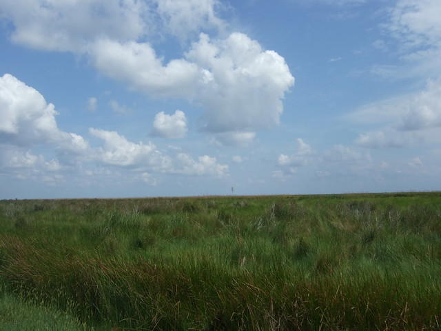
I was warned that the road with no shoulder starts soon after chalmette, and the point was well taken. From phone conversations, i thought the ride was going to end up like this:
and yet, i knew this had been done by the punx, by people with serious attention to fun rather than athletics; i had ridden to Gulfport and back and braved the tossed gatorade bottles of hwy 90 into the pearl river basin, with no shoulder to swerve into; honestly, it seemed much less intimidating than attempting to ride to the northshore and hit the tammany trace from new orleans.
and it proved to be fun. I think, because of the allure of television football, there were fewer people on the road in the morning than in the afternoon. the trip was more like this:
With one jerk zipping us there, and another on the way back, both in the area outlined in red. no bottles, though.
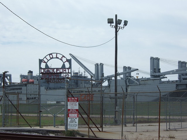
60 miles is about how much I can do without hurting the next day. we rode about 15 miles per hour, and with breaks, rolled into delacroix in 2.5 hours. There are gas stations all the way to Bayou Rd, but we had Becca drive to meet us out there with water. Next time, I'm bringing crab traps and stopping in Reggio. or staging a night ride to Violet Park.
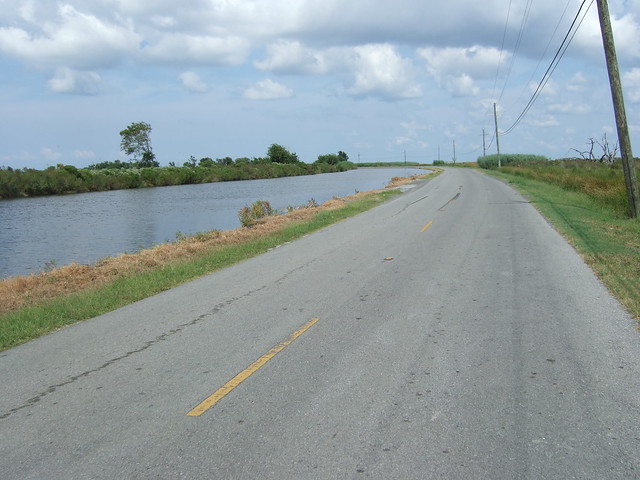
To start, the lower 9 after the st. claude bridge was an elegant ride, with style, in the door lane that goes to the parish line. St Bernard isn't so bad tho, until the 4 lanes become 2 east of Paris Rd. From there, the landscape gets more and more industrial, then rural--and the shoulder disappears in places.
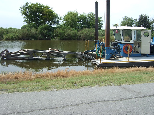
Once we hit the turn onto Bayou Rd, the traffic stopped considerably, probably because, unlike the 4-lane, the rd is blocked in two places before Verret. these roadblocks mean that you basically own the road--only fishermen are there. Even residents seem to use the 4-lane.
and, home again.
Tuesday, September 7, 2010
Thanks for the StreetCar Ride!
and the handout here:
We rode 50+ strong through the streets, no fuss, really. After a bit of rain, and a pause to say hey to former mayor Ray Nagin, we cruised to Plessy Park, where Homer Plessy stood up to integrate our trains.
Then we hit the Desire, transferred to the Jackson-Claiborne line, and rode the Bayou St John to the former streetcar barn at the end of Esplanade. After that break, we rode the City Park, transferred to the Canal, to see the station that still stands for the trains there.
We cheated a bit, I mean, we weren't riding on rails after all...and jumped over to the former St Charles line on Tulane Ave; then under the ever-flooded Carrollton underpass to transfer onto the Napoleon line at Washington st. From there, it was only a couple transfers from napoleon ave to the Peters line on Dryades, and then to the Louisiana line on, well, louisiana ave. We ended at the old Magazine shops, where we greased our human bearings with juice from the Breaux Mart.
Then we went to look at Darin's $1500 Sony No-Screen.
This month: Snoballs on Piety 17th September, and then...Delacroix? Westbank?
Friday, August 13, 2010
SnoBall Search Mid-Month Rides!
Snoballs, if you don't know, are popular summertime treats made with saved ice, favored syrups, and sometimes condensed milk or ice cream if you want to get fancy with it.
If you've never had one before, here's a good description from Mr. Edward Branley:
The sno-ball is truly a New Orleans creation. The main reason for this is a machine called a "Hansen's Sno-Bliz." This is the machine that turns blocks of ice into sno-balls. Most sno-cones are made of crushed ice; a Sno-Bliz machine shaves a block of ice, giving it an extremely fine texture. The classic sno-ball machine (now manufactured by four or five companies in the area) works like a deli meat slicer. I've never seen anything like a sno-ball in any part of the country, although Lani Teshima-Miller's description of "shaved ice" in Hawaii is the closest thing I've heard. A sno-ball isn't an Italian ice, nor is it a crushed ice abomination.
Once the ice is shaved, it's collected into a cup, paper cone, bowl, plate, or even a container akin to the things that you get at a Chinese take-out place. Then syrup is poured over the ice, making one of nature's most perfect foods. Some people continue the process, adding cherries, ice cream, ice milk, condensed milk, or other toppings.
We're hosting 2 rides to bring cyclists to the city's fine Snoball establishments.
On Friday August 20th, we're going Uptown starting at 5pm at the parking lot located at Magazine and Constantinople.
On Friday September 17th, we're headed Downtown starting at 3pm at Piety and the Levee in the Bywater (near Piety Street Snoballs).
Here's the route for next week's ride and a number of snoball stands we've located. If we missed your favorite, leave us a comment so we can add it to the ride.
View Sno Ball search in a larger map
Wednesday, August 4, 2010
Thanks, new orleans, for an awesome Wetlands Ride.
or not. meet in the parkinglot on magazine and constantinople.
Critical Mass! last week was awesome, despite a few hang ups, and a very long ride. I don't know when it ended, but only after we had taken two breaks, at the Spot in the East, and on the Lake as the sun set over pass Manchac.
I was worried about all the overpasses, but besides for one breakdown, everyone was able to hump it up over the rises. The almonaster bridge worked well as a traffic-free passage into new orleans east, an alternative to the Deathly Danziger bridge. even though the simple passage north from the bridge was blocked by a train, we were able to mount the Jourdan road overpasses and get onto chef / hwy 90. From there, though, I made a hasty turn onto Dale. This would not have been a problem except that I failed to turn left at crowder--which was goofy considering we stopped right there at crowder for 30 minutes on a break--that would have cut a mile or more off the route. as a consequence, we crossed the interstate at Read, which is more stressful.
In the interest of time and disorientation, we ended up going over at a place with no marsh. oh, but there is so much potential planting area there. The marsh at burke st was planted during a couple of days in 2007 and 2008. how much more marsh could we plant in a month of work? Coastal Restoration has to come out of our imaginations and into reality.
We left the levee at twilight, and took the haynes ave bridges in the dark. We couldn't go morrison road, because of construction, so that added a bridge to the route. We had one dude on a clunker throw a chain---his wheel was seriously out of true, but cory was there to help take his brake off.
We also had a detour onto Press instead of franklin, but because they've redone pontchartrain park, it was unexpectedly nice--Press runs into gentilly, and we took that new bike lane to franklin from there. That might be a shortcut, but i doubt it because press is curvy, and curvy the other way, away from our target of getting back downtown. We could have also scooted over to Alvar or Louisa, but these routes are either heavily trafficked or shoddily paved.
Sorry about the confusion about the Franklin overpass. you can access it from underneath the bridge, i think that's what people might have been doing? But it's a great route from the river to the lake.
thanks cory for running the support crew the whole time. If anyone has any photos, please send them to
criticalmassnolainfo@gmail.com
1) If you are interested in passing out flyers, please email me and i will send you the slips.
2) We also have business cards! great for slipping under people's brake cable housings! i laid out $5 for them. So if anyone wants to buy me a snoball...
3) I think we have run out of spoke cards, so if anyone wants to step up and make new ones, they are about $10 to run off.
See you next week!
scott
Monday, July 26, 2010
Mudslide into the Wetlands: Critical Mass Friday July 30th, 6pm Jackson Square
http://www.facebook.com/group.php?gid=2263490258&v=app_2344061033&ref=ts#!/event.php?eid=139155372763892&index=1
It's over right? the well is capped (almost), and we can just do back to thinking nothing ever happened, right?
The reality is the oil and the nightmare of coastal land loss is still among us, although more people across the nation and the world have awoken to our nightmare. Even in the city, we erect levees around our homes, levees that we think will keep the water out because they keep us from seeing it. The marshes that protect us have been threatened
ever more by this giant slick, these marshes that will continue to protect and feed us so long as they exist.
The truth is that we should have marshes right in our backyards--and in some places, we still do. Join us as we ride to New Orleans East, over hell and high water, to the closest marsh to town, on the south shore of Lake Pontchartrain.
20 miles, 2.5 hours. There will be some bridges, so come get high with us (And bring your bathing suit).
To make this ride more excellent, we need some additional help:
flyering --If you are willing to pass out flyers, please email me your
name and neighborhood, and I will email you the loop strips to print
out.
support --we also need a support car this time, so email me if you are
interested.
photography / video --if you are willing and able to shoot cyclists,
email me and let's talk about where you can set up.
Don't forget: there's another demonstration 31st July in Jackson Square, 2pm
Let's keep the pressure up, let's meet each other and work on our long -term oil problems.
http://www.facebook.com/event.php?eid=118253664889769
New Orleans Worldwide BP Protest Day - July 31, 2010 2pm
see you friday!
Thursday, July 1, 2010
Thanks y'all! Riding Strong through the Suburbs!
We rode 70 strong into metry, lakeview, and through the city park neighborhoods. Although we avoided all the bourgie mansions I wanted to pass en masse, we still fulfilled dreams and broke hearts by cruising down Veterans Blvd. Thanks to our friends who rode the LA Swift Bus from Baton Rouge to ride with us! I didn't know you could throw your bike on the bus--we'll have to return the favor sometime.
A reminder that our friends at RHUBARB need help closing down their current location by July 10th. fear not! Liz is looking for a new space already.
Check out the possible locations for next month (this is long):
Where we were this time out:
If you want to help with flyers, new spoke cards, posters, and route plans, let's meet up this coming wednesday, uptown at Rue at Oak and Carrolton. 6 sound good? I knew it would.
send all photos / photo links to
criticalmassnolainfo@gmail.com, and i promise a reporter next month.
look pretty for the cameras.
props to all corkers.
scott
Friday, June 18, 2010
Our good friends at RUBARB need your help!
*********************************
dear fans and friends of RUBARB--
we are closing down!! st mary of the angels, where we have been for over
4 years and have evolved into something quite wonderful, has asked us to
leave their property. they want us to get some crazy insurance we can't
afford and want us out by JULY 10th. we are respecting their request,
ending operation on that day and are planning to spend the following week
moving everything out. prior to that, on JUNE 26th, we will be having a
"repair-a-thon" and a farewell party. we want to get rid of some bikes
that remain, raise money, reflect on some great years, thank the church
and entire community, and most importantly... have fun!
so we need your help!
now more than ever. we need to find a temporary space to store our stuff
(if you can think of a potential spot, please let me know). we eventually
need a place to relocate to (we want to stay in the 9th w/d). we need
folks who would want to help repair bikes during the "repair-a-thon." we
could use people to perform during the party. we need people to help
break down the shop on JULY 10th and eventually help us move out by JULY
17th. we sound so needy, but it's true!
the most important thing to me, is the kids. i've seen a lot of them grow
up in that place, maturing, learning, playing, having a safe positive
environment to just BE. it's sad to think that they'll have no place to
go, esp on saturdays when we're crawling with kids (i'm hoping we can set
up on a corner somewhere while we're temporarily closed, to let kids fix
flats, make little adjustments, hang out).
we know everything will work out in the end, it always does. it's taken
hundreds of people from around the city and country to get to where we got
to, and no doubt that will happen again. change is challenging, but
change is good.
thanks for listening! holla at me if you want to lend a hand in any way.
spread this email around. send any contributions to:
RUBARB Community Bike Shop
PO BOX 770340
New Orleans LA 70177
check out our website for updates: www.rubarbike.org
with love and pedal power,
liz
Wednesday, June 2, 2010
Rim and Spoke: Downtown is not Uptown.
Anyone want to ride out to Delacroix Island, soon?
This series is and was a longer-term project to re-think cycling in New Orleans, to introduce new cyclists to a cyclist's geography, and provide the basis for some introductory, sneaky routes for tired or intimidated cyclists. So let's begin again.
Downtown is not Uptown
Previously, we discussed how the River is a potential aid to cyclists and how minding it tells us how to shorten a ride. The example was going from Uptown to Downtown, through most of Uptown. For the Downtown example, let's note what the Uptown street network has that Downtown doesn't: Broadmoor and Mid-City, two places where Spoke streets meet. Downtown, N. Peters through the Quarter is the equivalent to Claiborne Ave, in that it provides the tightest contiguous turn, the route with the least vector change. Broad, Miro, and Galvez are the Tchoupitoulii, the longer Rim streets to take when navigating out of Gentilly, the Eighth, and the Ninth. But there is no analog to Broadmoor: the Quarter is on the River.
So when we navigate Downtown to Uptown, we are more limited in our options. If we travel from MLK Jr., on Caffin Ave, to drink at the Deutsches Haus (while it's still there), we want to more toward the River, just as we want to move away from the River if Uptown. But the street logic is much more coherent, and the options are limited by our need to cross the industrial canal (IHNC).
In this way, Downtown New Orleans is more like cities in the rest of Southeast Louisiana: the urban area is very linear, and the waterways dominate the navigable landscape. Downtown also has less canopy cover, given that Downtown is not only poorer, but also more industrial than Uptown, which was conceived from original suburbs and swallowed satellite villages.
St. Claude becomes the choice of cyclists, despite that the bridge can hardly be called a bicycle "facility." There is no shoulder, and a patchy latticework forms the lifting section of the bridge, increasing the damage to tyres and tubes. but we'll return to the subject of bridges one at a time... The other options are Claiborne Ave Bridge, which is scary, and the Florida Ave bridge, which is operated or not operated inscrutably.
The Test: MLK to Deutsches Haus
So I devised a test of my previous theory: will hugging the river downtown produce the shortest route? Remember, the previous shortest route from Oak st to the Marigny was the route furthest from the river.
It seems that Downtown is a different world, because the quickest route from MLK to Deutsches house is the "straight shot": Claiborne. Although I wouldn't bike over the Seeber bridge--I'd take St. Claude over the industrial canal--it is the shortest route by half a mile. Our choices downtown are constrained by how we cross the canal.
So this test of our River Rule is interesting in how it fails.
This case is more like the one I was trying to make for Uptown--the safest, best route is not the shortest. But hugging the river actually makes for the third longest route--partly due to the course correction of 1.12miles, to get back to Galvez, which overrides the gain from following the river. The River route is still shorter than riding to Florida ave and then to Miro and Galvez more directly, but it's not the best option, because of the bridges.
Next time: Wormholes! quick but deadly! I promise.
Monday, May 31, 2010
Critical Mass: victory. Dead Pelicans Ride Monday 5pm Jackson Sq
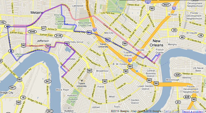
150 in number, we rode down canal to the cheers of onlookers. After one hiccup at City Park Ave, we strolled down Metairie Rd, broke, then took a left on Airline.
Because of a slight miscommunication, we ended up on the original route, Shrewsbury. which unfortunately is only formerly a street. (apologies to the woman who told me we weren't going to Central. you were right.) The sight of all those bikes portaging over the tracks is a memorable one, and unfortunately a practice required too often for cyclists in JP.
we did manage to lose our police escort at this point, only to be rejoined as we turned onto Jeff Hwy and back home via Leonidas. Jeff Parish was slightly more aggressive, but only to clear one lane of three. well, we can give them a lane.
The Dead Pelicans ride 5pm tomorrow. Dress Black, Ride Slow
-anyone have a mobile drum?
Kat is taking route suggestions. meet early, 4:30pm to talk routes.
This is only a beginning. the oil gusher won't end until the relief wells are done, probably around August. bigger and better, onward and upward.
So what are we doing for June? How can we support the demands of our rally? let's get together for planning and to contact media.
June 9th Rue on Oak and Carrollton 6:30pm
June 10th Sound Cafe 6:30pm
think floats.
ride safe!
scott
#######################
OUR DEMANDS
This a list of ten demands we are making of the federal government.
Note we are speaking to the federal government, NOT BP. BP’s chance to have any say or authority in this process should be long past. BP has proven itself a criminal enterprise concerned only with profit, recklessly and indifferently murdering its employees and the entire Gulf coast.
We demand the Federal Government intervene immediately to stop the BP Oil Flood and:
1. Declare the BP Oil Flood a national disaster so that Louisiana can finally begin getting federal assistance.
2. Stop BP’s use of “Corexit” and other chemical dispersants that present significant danger to health and safety.
3. Under a state of emergency, employ all resources (including Navy) of the government at every level – Federal, State, local, and parish — to defend our coast, our livelihoods, and our culture.
4. Suspend all BP contracts by means of the EPA’s discretionary debarment act and seize all of BP’s assets, including BP Atlantis and other operational offshore rigs, to assure that all costs of cleanup and remediation are covered.
5. Strongly enforce all regulations for workplace health and safety:
Cleanup crews must be supplied with and allowed to use full-face respirators, not paper masks.
6. Undertake immediate, full, and ongoing 3rd-party verified air-quality and toxicity testing in all affected areas, including New Orleans, and objective close monitoring of the oil leak to determine the true extent of the catastrophe.
7. End all deepwater offshore oil drilling.
8. Institute a temporary moratorium on non-deepwater offshore drilling (both current and new operations) and require each operation pass a stringent independent safety review before they can resume operation. Those that fail inspection stay shut down and are heavily fined until they comply or are debarred.
9. Keep all lawsuits related to the BP Oil Flood and its aftermath in Louisiana, and instruct the DOJ and States’ Attorney General to hold BP, Halliburton and Transocean accountable to the furthest extent possible under the law.
10. Found a two-decade TVA-Style Gulf Coast Authority that rebuilds sea walls, levees, coastlines, and wetlands, with a dedicated fund for fishermen and related industries to provide economic relief for those put out of work because of the disaster.
Tuesday, May 25, 2010
Street Bucklin' Heat, Y'all
http://www.nola.com/traffic/index.ssf/2010/05/five_kenner_streets_buckle_in_intense_heat.html
one wonders why we pave the GMO with materials that can't withstand the environment and compact the soil.
By Mary Sparacello, The Times-Picayune
May 25, 2010, 5:13PM
At least five locations on Kenner streets have buckled during the hot temperatures of the past four days, City Hall said Tuesday.
The Public Works Department said streets failed at:
-- 1500 38th St. near Greenlawn Terrace Elementary School
-- 661 Mayfair St. in the Holly Heights subdivision
-- 3600 Loyola Drive in University City
-- 3419 Florida Ave. in Greenlawn Terrace
-- 2400 Tifton St. in Veterans Heights.
Sunday, May 23, 2010
Banner Making this Tuesday 7pm @Nowe Miasto
let's make Banners, to help set the tone for our ride this Friday, May 28th, 6pm.
We are meeting at Nowe Miasto, at the end of Jane Place, off Broad and Banks in MidCity. The time is 7pm Tuesday, the 25th.
Please bring
Bamboo
craft wire
Old Campaign Signs
White Bedsheets
Paint
Markers
or any materials that will help us construct mobile signage.
see you there!
scott
scott@nolacycle.com
Friday, May 21, 2010
TOMORROW (SATURDAY) - ANNUAL BICYCLE SECOND LINE PARADE!!!!
---------------------------------------
http://www.mbcnola.org/SecondLine.html
WHAT: 2010 Bicycle Second-Line
WHO: Featuring the Crescent City Stompers
WHEN: Saturday, May 22nd, 2010 formation at 10:00am; departure at 10:30am
WHERE: Commencement at Magazine Street and Zoo Drive; After party at Avenger Field (Tchoupitoulas and Exposition Blvd.)
View Bicycle Second Line in a larger map
WHY: To show cycling enthusiasm for New Orleans, and learn about cycling improvements in the city
WITH: New Orleans EMS and the National Safety Council hosting a Bicycle Rodeo starting at 8am. Rodeo held at Audubon Charter School (428 Broadway). The first 50 families to either join or renew MBC will receive free helmets for their children.
View Larger Map
ALSO:
$25 for membership or membership renewal and 1 free t-shirt *note: free t-shirt is for full paying members only, not discounted student memberships
$15 for just a t-shirt, and
$5 for an existing member who wants a t-shirt
Wednesday, May 5, 2010
Link to download the latest NolaCycle poster
Tuesday, May 4, 2010
Rim and Spoke: the River Built Everything
The first lesson, then, to New Orleans is to forget your compass and follow the River. Uptown is the direction Upriver; Downtown is the direction Downriver. Don't move north and south, but to the River or away from the River. While you are in the city, away from the River always means toward to the Lake, Lake Pontchartrain.
You can blame all of New Orleans on the Mississippi River, because it built the soggy land we ride on. It built the streets crooked to confuse midwesterners. It built it flat so that you won't wear your knees out pedaling that beat up cruiser bike. It built it wet, so that the pavement sinks, settles, and slides at different rates, making potholes, sinkholes, and buckled pavement. It built it low so that you have take bridges to get out of town. And when we stopped it from building New Orleans, we started to lose it to the Gulf of Mexico.
Re-establishing the ecological function of the river is the only way to stave off coastal land loss and the destruction of New Orleans. Those are called Diversions, and apparently, they are also handy during incredibly bad industrial accidents, like Oil Rivers flowing at us from the Gulf bottom. The River is the cyclist's ally in the fight against fossil fuels.
Being mindful of the river and its curve can also get you where you're going faster.
For example, if you work on oak st, and live in the marigny, you might think it's easiest to ride annunciation, since you might drive tchoupitoulas (to avoid traffic at carrollton, 'natch). But if you ride that rim, it's the longest possible route--which matters for a cyclist, especially one carrying a load on her back.
There are several shorter ways than annunciation, which is probably the longest way, since it is the rim farthest from the "hub" of broadmoor. Whether or not these ways are quicker depends somewhat on your riding style, but let's examine the route length to start.
In the red, a route through the park, onto prytania. a cool 8.2 miles, but one on a well-paved, well-shaded street. If you take prytania, you won't have to make too many decisions about where to turn, but you'll take extra time getting to where you're going. And then, you usually have to bike back.
Moving closer to the hub of broadmoor, the blue line is a "Liberty" rim route, with a few more jukes to avoid one ways and bad streets. It measures around 7 miles. This is a route that takes advantage of our nolacycle data, pointing to the decenly paved streets often overlooked.
Note that all of these routes, once they hit the CBD, try to hug the "hub" of the marigny riverbend: the change in the river course means that riding close to the river as it turns away from the city is shorter than riding close to the river as it turns in.
The shortest rim route is a "Claiborne" route in green. Here, I tried to choose a route that would be equal in distance to the "Liberty" route. I thought it would be longer because of the long stretches spent correcting the course on spoke streets to avoid the deathly Claiborne overpass and to return to the river at the CBD. But the route closest to the hub in Broadmoor totals 6.67 miles, shorter than the Liberty route, with fewer jukes and better pavement for increased speed--it's clearly the fastest route. The traffic on Claiborne can be intimidating, but it's by no means a killer for an experienced rider.
This rule of navigation can even help you save time in a car; the highways through New Orleans are also an exception to it, as traffic managers made efforts to subvert the river-based logic that built the original grid.
Next time, we'll touch upon these "Wormholes"; where they are useful and where they can destroy you.
scott
Tuesday, April 20, 2010
Public meeting on transportation this Thursday at the Regional Planning Commission
Details from Walter Brooks at RPC:
Public Meeting - Metropolitan Transportation Plan
The Regional Planning Commission is inviting the public to participate
in a transportation planning workshop. Interested citizens are being
invited to discuss their community's transportation needs and to help
shape a better integrated land use and transportation plan for the New
Orleans region.
The RPC is currently updating the region's long-range Metropolitan
Transportation Plan (MTP) and short-range Transportation Improvement
Program (TIP). Citizens will be asked to identify their ideas for
improving the region's transportation systems as well as ways to foster
livable communities and environmental sustainability.
RPC wants to know about transportation problems, needs, or priorities in
your community. All ideas or suggested projects will be reviewed and
evaluated by RPC staff for possible inclusion in the Plan or TIP. RPC
will also provide you with the opportunity to stay informed about
transportation plans and projects that relate to your neighborhood or
community.
The workshop will be held at the Regional Traffic Management Center/RPC
offices located at 10 Veterans Memorial Blvd. in New Orleans on
Thursday, April 22, 2010 from 6:30-8:00 P.M. The building is ADA
accessible and parking is available on site. For special accommodations
for this meeting, please contact our ADA Coordinator by telephone
(504-483-8528) at least one week in advance. Upon request, RPC will
provide appropriate aids for qualified persons with disabilities so they
can participate, including interpreters for persons with limited English
proficiency.
Walter Brooks
Executive Director, New Orleans Regional Planning Commission
Monday, April 19, 2010
New Orleanians are bad at (road) diets
Gentilly Blvd. through Gentilly, is now 2 lanes in each direction (instead of 3) and includes a bike lane with a striped buffer between the furthest right car travel lane and the bike lane. The idea behind the buffer is reduce the number of lanes of car traffic (since 3 was too many for how many car trips the road sees on average daily) which encourages more careful (and hopefully slower) driving behavior and reduces the number of lanes pedestrians must travel through to cross the road.
Here are some pictures I stole from Tim Eskew of Bicycle Michael's. This shows the bike lane and buffer (which changes size based on available space) at a few points along the road. Some diagonal striping has also been added in some sections, though not seen in these pictures.
Portland has started using this type of bike lane (called enhanced bicycle lanes), finding it works better than bike lanes with raised buffers or landscaped barriers (called Cycle Tracks). Here's some Q & A from the Portland Bureau of Transportation via The Oregonian about this kind of design:
What is an enhanced bicycle lane?
An enhanced bicycle lane is designed so that it provides a more protected and comfortable space for cyclists than a conventional bike lane and does not have the same barriers to sight lines as a Cycle Track - where view of cyclists may be obstructed by parked cars.
Why are we constructing enhanced bicycle lanes (i.e., what's wrong with these streets the way they are now)?
These streets currently work fine for people who are comfortable riding bicycles in mixed traffic. However, our designs are intended to make bicycling more comfortable for the majority of Portlanders who are not comfortable riding under such conditions. Our analysis indicates that most Portlanders would use a bicycle much more often than they currently do if they didn't have to mix so much with automobiles. A buffered bicycle lane provides that opportunity.
Why not use a simple bicycle lane?
Because the enhanced bicycle lane, with the added shy zones, offers a more comfortable riding environment that we believe it is more consistent with our efforts to make bicycling a part of daily life in Portland.
How does an enhanced bike lane provide more protection for cyclists than a bike lane?
Enhanced bike lanes provide more protection for cyclists by providing 'shy' or buffered zones on either side of the cyclist.
What will drivers notice that is different about driving on a street with an enhanced bike lane?
There isn't much of a change for drivers. They will still need to watch carefully for cyclists when they are turning right at cross-streets or driveways. They will also need to take care when parking on-street which is accomplished by crossing the enhanced bicycle lane. Cyclists will always be clearly visible to drivers because, unlike a Cycle Track, the buffered bicycle lane does not have the barrier of parked cars between the bicycle lane and the travel lane.
New York City cyclists are also big fans of this design, according to Streetblog New York City. A study was done finding most cyclists felt more comfortable biking on buffered lanes than non-buffered lanes.
So all in all, looks like these new buffered bike lanes should be pretty awesome for New Orleanian cyclists. Hopefully they'll encourage more people to bike instead of drive. I haven't rode them myself yet, but Jennifer Ruley at Department of Public Works has given them the first hand thumbs-up and Tim is pretty happy as well.
I did, however, drive down Gentilly Blvd today on my way back from Lakeview. I wanted to figure out how many miles it was from my house to the Fairground if I traveled St. Claude Ave. to Franklin Ave. (newly resurfaced and looking lovely - but no bike improvements, yet at least), to Gentilly Blvd. It's really not too far, considering it will allow me to avoid the insanity of Mid-City during Jazz Fest. But I saw something pretty disgusting on my way home:
Between Elysian Fields, past Franklin Avenue, I saw at least 3 cars travel in the buffered bike lane! Obviously, New Orleanians aren't really sure how to do a road diet. In all fairness, there are no signs explaining cars must stay out of the buffer zone, though anyone with a drivers license should know diagonal white strips don't equal a car travel lane. Also, I haven't seen anyone bike Gentilly the two times I've driven down it since the lane went in.
If you're biking down Gentilly Blvd., keep an eye out for cars in your bike lane! If you can, write down the plate number and report it to the police. Hopefully as more people start biking on Gentilly, less cars will try to use the bike lane as a short cut around traffic. Also, if enough people report these acts to the police, maybe they'll start monitoring the area.
New Orleans drivers are going to need more help, beyond just striping, if they're going to be successful with this new diet.
But hey, Gentilly Blvd, 4 lanes looks good on you. You we're kinda chubby back when you were a 6. I don't mean to be a jerk, but I really didn't want to go on a bike ride date with you back then. I think you look pretty hot now. Want to be my bike route?
Low-cost, one-day course in bicycle infrastructure design this Wednesday
Registration is officially closed, but if you contact Dan Jatres via e-mail (djatres@norpc.org) or phone (504-483-8505), you may still be able to reserve a spot for Wednesday's bicycle course. The cost is only $20 for public sector employees and members of community groups. If you work for a private sector firm (real estate, construction, planning, architecture, engineering, etc.), the fee is $100.
Topics to be covered at Wednesday's bicycle workshop
- Principles of bicycling and designing for bicycling
- On-road bikeway designs
- Intersection design for bicycles
- Signing and marking facilities
- Shared use path design
- AASHTO Guide for the Development of Bicycle Facilities ($45 value)
- Professional development credit: LAPELS, ASLA, APA
Thursday, April 15, 2010
Do you know how to put together and take apart a bike? Are you free this weekend?
Thanks!
Rim and Spoke: Navigating New Orleans by Bike
There are a few types of geographical quirks to New Orleans. Some we have in common with our sister cities in southeast Louisiana--others are unique to our estuarine, industrialized metro area. There are many tricks to navigating by bicycle--especially for those of us who are small, inexperienced, or just don't want to deal with cars. I hope to introduce new cyclists, or new New Orleans cyclists to the city and its tricks so we can all ride a little lighter on our sinking roads.
You can use these parts of your bike, the rim and the spoke, as a schematic to the older parts of the city. The city was originally designed along the French "arpent" system, which assigns lots perpendicular to the River, rather than the "township and range" system used in most cities in the U.S. as well as the newer, lower, more American New Orleans.
The Arpent system is why there are many streets that "disappear" as you ride from the River to the Lake while uptown, and many streets that come from nowhere as you ride River to Lake when downtown. Because the river meanders this way and that, the grid shifts direction. Carrollton meets Esplanade at the park, despite the fact that they both run River to Lake. Tchoupitoulas begins pointing south from Canal St, and ends up uptown pointing west into Audubon Park.
As you decipher the city's curves, you can use this schema to juke around without getting disoriented if you have to avoid a familar street for the cars.
Unless you're in Broadmoor. Then you're lost.
scott eustis
Next Time: The River Built Everything
*You can learn more about this from city geographers like Craig Colton and Richard Campanella.
Saturday, April 10, 2010
No afternoon shift for mapping along the Lafitte Corridor today
Thursday, April 8, 2010
Additional info about the Lafitte Corridor mapping events
Also, if you want to help update the road condition data NolaCycle collected for area (most of that was mapped between a 1 and 1 1/2 years ago), please bring your bike and a bag/backpack to carry the clipboard. For any shift with a large turn out, we'll send a few people out to do updates.
We will have some snacks, but remember to bring your own water bottle.
Monday, April 5, 2010
Location of this weekend's mapping meet-ups
View Lafitte Greenway Mapping Meet-Up in a larger map
Saturday, April 3, 2010
Help make the Lafitte Corridor Trail a reality!
Many planning projects involve community asset/resource assessments, but they are usually completed by urban planning, community development, or engineering professionals. Lauren has been working with folks from Rails-to-Trails on adapting their assessment system to an urban environment and creating a mapping methodology to incorporate volunteers. We're going past the basic data collected with NolaCycle and looking at objective measures of sidewalk quality, crosswalk treatments, signage, bike parking, and striping.
The data we collect will be used to design further bicycle and pedestrian improvements in the Mid-City, City Park, and Treme neighborhoods, and advocate for their implementation. We want to insure that when the Lafitte Greenway is built, it will be well-connected to the surrounding neighborhoods via safe, accessible sidewalks and bike-friendly roads.
We're in need of a large number of volunteers. Each group of volunteers will be lead by a bike/ped expert, so you don't need to be an urban planner or traffic engineer to contribute. You just need to be observant!
If you'd like to help, please sign up for the shifts you can commit to working at http://tinyurl.com/lafitte.
If you have any questions, please send me an e-mail.
Thursday, April 1, 2010
Lauren's ramblings concerning the recent wave of Plan B bashing on Craigslist
Plan B is a community bicycle shop in the Marigny. It's a place anyone can go to build or repair a bike for little to no money. If you haven't been there and you would like to do your own bicycle repairs, or you're thinking of building a bike, check it out.
But...like all community bike shops, it's not perfect. And sometimes it can feel exclusive. So here's what some folks on Craigslist said followed by how I feel about Plan B (and community bike shops in general) and my recommendations to people who want to utilize the community bike shop.
Here's a sampling of the CL rant:
1st post (from Plan B): Plan B Community Bike Shop is graciously accepting donations (511 Marigny (Marigny and Decatur))
Ladies and Gentlemen!
Plan B is looking for bicycle donations of all kinds
We don't discriminate; drop off bikes of any age, size, color, or design.
We can use anything you have to offer
whole bikes or spare parts
advanced or obsolete
It's all good...
If you are interested in learning about bike maintenance and repair...
Volunteer orientations are every Wednesday @ 6pm
Show us what ya got
Help out a little around the shop
Sincerely,
Plan B
http://www.bikeproject.org/
2nd post (from some dude): Plan B doesn't appreciate parts (Hipster ville)
I donated a big box of parts there once.All kinds of quality items.I came in and said I have a bunch of parts for you.The guy in charge literally shrugged his shoulders and went back to what he was doing.He didn't say a word! I wasn't looking for praise but I certainly didn't want to be treated like a jerk!So if you wear clean clothes and wash your hair you may not be welcome here.
3rd post: agreed on PlanB bikes (reality)
if i had bike parts to donate, i would give them to Bridgehouse before i gave them to PlanB.
i went in there once and was violently ignored. maybe they sensed i **gasp** drove my car there!! i finally had to inturrupt someone to ask for if they had a certain bike there, and after this girl gave me a once-over and walked away, i asked someone else who said no. they dont have that there. no helpful advice or anything! i felt like i had done something wrong! guess that's what happens when gutter punks start a 'business'.
dont get me wrong - i think bike rinding is great and necessary! but if PlanB hates outsiders so much, they should shut their doors.
Another post (from some dude): Plan B.......
This is straight from their web site. I just copied and pasted.
Although Plan B volunteers can be quite surly, we can be ever so gracious in the face of generosity.
Apparently "gracious" has very loose meaning
And it sorta goes on from there...
Here's how I feel about all of this (This only reflects my opinion and not particularly that of anyone else involved with NolaCycle):
Plan B is a great resource, with a lot of great volunteers, but it's not perfect. As someone who has been a regular visitor to 4 community bike shops in a couple different cities, let me help put things into perspective.
Concerning volunteers:
- Volunteers are regular people like you, who have good days and bad days. They have days when they really didn't want to work but someone who was scheduled didn't show up, so they might not be as happy to help as you might want them to be. And when it's 3pm on a Saturday and 25 people are all asking you questions because you're the only "regular" volunteer who knows where things are and how to fix various problems, working at Plan B can be stressful. Cut them some slack if they aren't as helpful and nice as you might want them to be.
- Some volunteers are "people persons" and others are not. Some of the folks who might not seem really friendly or helpful still play critical, not-so-visible roles in keeping Plan B going. They are not the person you ask to help you straighten your wheel, though. At Plan B, or any other busy community bike co-op, you will probably need to visit a few times before you figure out who your "volunteer match" is. You will love some volunteers (not all volunteers), and they'll love you (but not all volunteers will love you), and after you find your volunteer match, together you will build solid wheels, replace broken pedals, and maybe, someday, weld together a custom bicycle. Remember what days they normally volunteer and try to only go to Plan B those days. They'll remember what you're working on and what you need help with (maybe you know how to true a wheel, but you're still learning how to adjust brakes and shifters). And you'll remember their name, and where they grew up, and what they do for a living, and their favorite beer because you're probably going out to the bar with them after the shop closes. But remember, your volunteer bicycle repair BFF is probably 20 other people's BFF, so you have to share. If you work on bikes a lot, and need a lot of help, then try to build relationships with multiple volunteers. You will most likely need to initiate this process, though. If you don't ask for help or try to engage people in conversation, they're going to be too busy and seem to be ignoring you. Also, how are they supposed to know what you need help with if you don't ask? And, finally, no one is going to want to help you if you're rude, just like how no one wants to be friends with a jerk. Community bike shops are sustained on relationships. If you want to have a good experience at a community bike shop, you need to build relationships. If you don't like to share the attention of a volunteer, or you don't want to spend time getting to know people, then go visit John Gerken at his shop on St. Claude, call Zac of Nola-Bikes mobile repair, or any of the other bicycle mechanics working at shops around the city (Bicycle Michael's, Bayou Bikes, etc.). You can pay these folks to be your bicycle repair BFF and they will devote their full attention to you (at least for the time you are in their shop spending money). You have to pay for "customer service." Plan B does not exist as an alternative to bicycle shops. Think of it more as a supplement.
- Plan B gets a lot of donations. A lot. They might not seem too excited about your "good parts" because they have five more boxes of good parts in the back room. If you want to bring a smile to the face of the "guy in charge" then bring him parts that are already sorted. Like one box of side-pull brakes, one box of road bike seats, and another box of front derailleurs. Every box of unsorted parts means another hour of volunteer time that has to go into sorting donations instead of helping people fix bikes.
- Some parts are junk. Some bikes are junk. Some parts are awesome. Some bikes are awesome. If you bring in a really awesome bike or some really awesome parts, then the volunteers will be a lot happier. Plan B gets a lot of junk Walmart bikes and lots of parts from junk Walmart bikes. If a person is going to take the time to build/repair a bicycle, he or she is going to want a solid frame and dependable parts. If you bring in your grandpa's 1972 Nishiki road bike that's been sitting in his garage for 15 years, that's a lot more helpful to Plan B and the New Orleans cycling community than if you drop off the Walmart Huffy your kid destroyed when he actually tried to use his "mountain bike" for mountain biking.
- Bicycle repair classes. Volunteers don't always have time to teach people everything they need to know during regular shop hours. It would be awesome if they did some classes so folks could really learn how to do particular repairs. Mobo in Cincinnati does this from time to time and it's been really successful.
- Making a serious effort to be nice to everyone. Yeah, despite everything I just wrote, there are some people who volunteer at Plan B that could really try to be friendlier. But I still think those people add a lot to the organization. It just really sucks that their attitude pushes people away.
FINALLY - Plan B is not a store, and it not a repair service. It's a resource. While you can buy parts there and someone might be able to help you fix your bike, it really exists so the bicycle community has a place with all the resources (stands, tools, an extra set of hands) needed to do their own builds/repairs.
Plan B is what you make it. Last summer, largely due to the friendships I built with a few volunteers, it became one of my favorite places to spend an afternoon. Some of those friends are no longer volunteers, which at first made going their a little more intimidating than it used to be. But one trued wheel, a few borrowed wrenches, and a handful of conversations later, it started to feel like one of my favorite places again. I met some new volunteers I really liked and got to a chance to work with some old regulars that I never really talked to before.
Maybe you'll see me there tomorrow when I bring in my cruiser for a part replacement. Even though I'm not a volunteer, you can still ask me for help. And I might ask you to hold my bike steady while I do a repair. And I can help you flag down one of the volunteers to help you with a problem I don't know how to fix. That is what a community bike shop is like. If that's not what you're looking for, then Plan B is not the place you need to be.
Monday, March 29, 2010
One more Master Plan meeting added - District C East Bank
When: Wednesday March 31st, 6-8pm
Where: Musicians Union Hall, 2041 Esplanade Ave.
Why: Community input is VITAL to successful planning efforts. Let your voice be heard!
Tonight I'm going over the Lower 9th Ward for their meeting. I've been kicking around the idea of moving to Holy Cross this summer since it's home to nice folks, awesome community projects, and it's about as close to country living as I can get in the city without going way out in East. Here's the 411 on that meeting.
When: TONIGHT 6:30-8:30pm
Where: New Israel Baptist Church, 6322 St. Claude Avenue
Why: Because you love the Lower 9th Ward too. Show your support to projects to help revitalize this unique and historic neighborhood.
Yay, urban planning!
Sunday, March 28, 2010
Please sign the online petition Keep New Orleans' Bicycle Registration Fees Reasonableo
The current city ordinance on bicycle registration:
Sec. 154-1403. Registration required.
No person who resides in the city shall ride or propel a bicycle upon any street unless such bicycle has been registered and a registration plate is attached thereto. This section shall be applicable to new residents of the parish at the expiration of 90 days.
(Code 1956, § 38-192)
Sec. 154-1404. Registration application and fee.
(a) Application for a bicycle registration shall be made upon the form provided by and shall be made to the superintendent of police. There shall be a registration fee of $3.00 for all bicycles with a 20-inch wheel size or larger. The dealer shall collect such fee at the time of sale, issue bicycle registration decal, and remit the fee to the superintendent of police along with the application for registration.
(b) This charge becomes effective as of February 1, 1987.
(c) Exemption for the payment of fees shall be for all bicycles under the cost of $100.00.
(Code 1956, § 38-193)
Sec. 154-1405. Issuance of registration; record.
(a) The superintendent of police or any police officer assigned such duty by him, or the superintendent of fire or any employee of the department of fire when assigned such duty in writing by the mayor, upon receiving proper application therefor, may issue a bicycle registration plate to the owner thereof. Each new owner shall register such bicycle in accordance with the provisions of this article. They shall not register any bicycle when they know or have reasonable grounds to believe that the applicant is not the owner of or entitled to the possession of such bicycle.
(b) The superintendent of police and the superintendent of fire shall keep a record of the number of each registration, the date issued, the name and address of the person to whom issued and the number on the frame of the bicycle for which issued and a record of all bicycle registration fees collected by them.
(c) It shall be the duty of the superintendent of fire to forward a true copy of the record of each registration made by him, or any employee of the department of fire, to the superintendent of police.
(d) The superintendent of police may authorize bicycle dealers to register and attach registration plates to bicycles. All such persons authorized to register and attach registration plates to bicycles shall forward immediately to the superintendent of police true copies of such registration. It shall be a misdemeanor to fail to furnish such copies or to furnish false or fraudulent records to the superintendent of police.
(Code 1956, § 38-194)
Sec. 154-1406. Attachment of registration plate.
The superintendent of police or other authorized person upon issuing a bicycle registration shall also issue a registration plate bearing the registration number assigned to the bicycle, and the name of the city. The superintendent of police or other authorized person shall cause such registration plate to be firmly attached to the frame of the bicycle for which it has been issued in such a position as to be plainly visible. No person shall remove a registration plate from a bicycle during the period of ownership for which it is issued except in the event the bicycle is dismantled and no longer operated upon any street in the city.
(Code 1956, § 38-195)
City Council does need to address the issue, because police should not legally be able to issue a ticket for a registration sticker residents cannot obtain, but Councilman Carter's proposal to raise fees to $15 a bike for non-commercial use and $75 for commercial use has not been completely hashed-out. Where is the registration money going? How will the new registration system help deter theft? What considerations have been made for the thousands of low-income residents who use a bicycle as their main form of transportation? A lot of questions remain unanswered.
NolaCycle, Metro Bicycle Coalition, N.O. Bike Polo, and 311 individual cyclists (as of 3/28) would like you to sign the online petition encouraging well thought-out and financially reasonable bicycle registration laws in New Orleans.
Petition text:
To: New Orleans City Council
We, the undersigned, request the City Council examine our concerns about Councilman Carter's proposed Bicycle Registration Fee hike to $75 for commercial use and $15 for non-commercial use (amendments to Sections 154-1403 through 154-1406 of the Code of the City of New Orleans). While an effective bicycle registration program can be a valuable resource, the magnitude of this increase (500% for non-commercial and 2500% for commercial) will be a hardship for some cyclists and feel like a punishment to others. The following outlines our primary concerns:
- The ordinance does not specify how the collected fees will be used by the city
- An increase of this scope should involve greater public participation to insure an effective registration program
- Low registration fees will encourage citizens to participate in the program, which will in turn discourage theft and promote ridership.
We appreciate your attention to this matter.
Sincerely,