NolaCycle is a project aimed to create a high quality cycling map of New Orleans. Cycling maps include information beyond just streets and their names that benefits cyclists. In our map, we highlight the pavement quality, car travel speed, lane width, and special caution areas (busy intersections, man-eating potholes, or high accident areas). Volunteers help to collect this data by attending mapping events.
The information is then digitized to make a map of the data we collected to help cyclists - young, old, local, and tourist alike - navigate New Orleans.

Check out the blog for updates on the project, ways to get involved, and volunteer mapping events!

If you have questions, feel free to make a public comment on the blog entry or e-mail us directly at info@nolacycle.com.

Thursday, April 18, 2013

nolacycle 1898


And if our NolaCycle data isn't out-of-date enough for you, we have this!

Map of the City of New Orleans, showing the various Street pavements, system of house numbering and street carlines, with desirable drives throughout the city (click on the image to view full-size).

Published by the Southern Cycling Association in 1898.

NolaCycle GIS shapefiles, posters, papers, and powerpoints to help you with your bicycle mapping projects

After some digging around, we've recovered the GIS files for the NolaCycle map (current as of April 1, 2010).  I've posted these, and some other documents people might find informative, online at https://sites.google.com/a/nolacycle.com/nolacycle-files/.  Graduate students, planner, and bicycle advocates, please feel free to use these documents to help you with your projects.  If anyone is interested in using our data for a commercial project, such as a mobile app, please email me at lauren(at)nolacycle.com for special permission, as I would require you to make some donations to local bicycle organizations in exchange. 

We're working on getting some things fixed on the NolaCycle Map site so we can download the database again to use the updated information (though it's not very current either).  If anyone is interested in a login to the NolaCycle map site to do updates in their neighborhood, let us know.

Crowd-sourced bicycle mapping has come a long way since NolaCycle started in 2008.  If you're interested in checking out some cool new projects that harness the power of smartphones, look into Hit the Pothole and CycleTracks.

If you'd like an up-to-date map of official bicycle routes in New Orleans, Bike Easy's Bike Map and Guide to Safe Cycling is available online as a PDF.

Thanks for all your help and support over the years! 

Saturday, January 5, 2013

Cheapest bike lights


Many people ride in new orleans without bike lights. This is foolish, honestly. As much as i love riding in the darkened streets under the moonlight, it's a good way for cars to hit you.

So i've been thinking about a way to achieve a decent LED bike light that lasts months for very little money, one i could distribute to people you see riding dark.

This is especially nice if you are a parade or ride organizer, and want to distribute lights among your riders / paraders--since the lights are not the kind that last an extremely long time.

The lights.

For some reason, you can buy 10 LED lights from a bargain hong kong distributor for about $16. This is less than the cost of two 2016 batteries that you get in each light. If you wanted to run a cheap battery scam...

cheap bike light with rubber band
a bag of lights, and the finished device on my finger

The rubber band holds the light tight against the frame (or a finger). These particular lights come with a key ring, which makes the task of wrapping the light around the frame easier. but, you could also thread a rubber band through the hole in the light itself.

the mount, here demonstrated on my finger

finished!

the light activates with a button or a switch. the switch is what you want to use, naturally.


Re-using?
Here's the internals of the light, showing the 4 screws, and not showing the the 2x2106 button batteries. if you want to re-use the LED, i'm thinking the batteries can be replaced. of course, it's cheaper to buy new, and the most toxic / ecologically costly component of this setup is the batteries.

Sunday, March 11, 2012

Update on Nolacycle

Since 2010, not much as happened with NolaCycle. A lot has happened in my life, which has kept me from the project, but on positive note, a lot of great things have happened for cycling in New Orleans since then too. We have miles of new bike lanes, more bicycle parking, pedicabs, a complete streets ordinance, and many groups actively engaging in advocacy in the city. Our data map is online though, and anyone can view it and use data from it. You can view it at http://nolacycle.noladata.org. It's a bit out of date, especially considering how many road improvement projects have been completed in the last couple years, but you might still finding it useful for planning your bicycle routes around the city.

Currently, I'm in the midst of deciding where to go to graduate school, so I don't see myself being able to pick NolaCycle back up in the next few years. I do plan on making all my work and the work of volunteers for the project publicly available in May. The posters for NolaCycle have already been posted in entries from April 2010 and June 2009, giving a good background on the goals of the project and the methodology.

Thanks again to all the wonderful people who have been involved in NolaCycle. Another big thanks to everyone in the community and local government who has carried on NolaCycle's mission and has made New Orleans a much more fun and comfortable place to cycle than when I first moved her in March 2008.

Saturday, April 30, 2011

where we actually went.

thanks for riding! 50 strong! let's help each other work on building the mass next week! the ride gets more and more awesome with each rider.

Friday, April 29, 2011

Critical Mass Ride! 6pm Jackson Square

come explore the new bike lanes, and ride the park! 12 miles, 3 hours

Monday, February 14, 2011

picture post: parking and lanes

No Parking at new Lakeview Grocery (Robert's)

Bike Parking at Lakeview Grocery

No Parking at Rite Aid

Bike Parking at Lakeview Grocery

Parking at Bean Gallery

Bike Parking at Bean Gallery

New Bike Lane on Orleans! updating the map...

bike lane on orleans

Monday, November 1, 2010

dirty coast compass rose


Just a word on navigation, (and i know i'm a million years late on this) dirty coast has a tee shirt for sale with a singular "new orleanian" compass rose overlaid on the map of the wards. Instead of North, South, East, West, the rose displays "Lake, River, Downtown, Uptown."

the only problem i have with it-- how are you supposed to look at the shirt when you need to find your way? maybe i can get it printed upside down, and grow a beer gut. you know, for navigation purposes.

scptt

Friday, October 29, 2010

CRITICAL MASQUE Cemetery Ride To-NITE! 6pm Jackson Square


CRITICAL MASQUE Cemetery Ride To-NITE! 6pm Jackson Square

the dead drive the streets, burning fossil plants on their blind way.
encased in steel, they no longer feel the sun, no longer do they feel the bump of the earth and the contour of the land,
no longer do they hear the wind or see their fellows teeming in the hundreds beside them
the dead drive and drive to and fro in cattle lines, unsullied by the heat of the sun or damp of the chill air
the dead hand of greed drives us into war for oil and toil for a scorched earth,
the dead drive the state and the nation into the sea, which rises into the heated air to swallow us
for what do the dead fear? The dead cannot drown.

but we the living ride, masked to cheer the dead hands that drive our lives, to call them forth to all hallow’s eve.

Let’s Ride Bikes! Critical Masque Cemetery Ride TONITE! 6pm Jackson Square
A tour of the cities of the dead, in a city not long for this world
http://www.nolacemeteries.com/

15 miles, 3 hours. now dressed!

Tuesday, September 28, 2010

Bike Ride to Delacroix


A bike ride to delacroix on a sunday football weekend. People thought they couldn't do it, people thought i was crazy, several people backed out, or only wanted to do half. I'm sorry that nothing was decided beforehand, but planning takes work, work that was largely unnecessary, thankfully. Thanks to Asher, Chad, Tom, and especially Becca for running support, and Victor for his tips. In the end, I think we had more support than riders.


I was warned that the road with no shoulder starts soon after chalmette, and the point was well taken. From phone conversations, i thought the ride was going to end up like this:


and yet, i knew this had been done by the punx, by people with serious attention to fun rather than athletics; i had ridden to Gulfport and back and braved the tossed gatorade bottles of hwy 90 into the pearl river basin, with no shoulder to swerve into; honestly, it seemed much less intimidating than attempting to ride to the northshore and hit the tammany trace from new orleans.

and it proved to be fun. I think, because of the allure of television football, there were fewer people on the road in the morning than in the afternoon. the trip was more like this:


With one jerk zipping us there, and another on the way back, both in the area outlined in red. no bottles, though.

60 miles is about how much I can do without hurting the next day. we rode about 15 miles per hour, and with breaks, rolled into delacroix in 2.5 hours. There are gas stations all the way to Bayou Rd, but we had Becca drive to meet us out there with water. Next time, I'm bringing crab traps and stopping in Reggio. or staging a night ride to Violet Park.


To start, the lower 9 after the st. claude bridge was an elegant ride, with style, in the door lane that goes to the parish line. St Bernard isn't so bad tho, until the 4 lanes become 2 east of Paris Rd. From there, the landscape gets more and more industrial, then rural--and the shoulder disappears in places.


Once we hit the turn onto Bayou Rd, the traffic stopped considerably, probably because, unlike the 4-lane, the rd is blocked in two places before Verret. these roadblocks mean that you basically own the road--only fishermen are there. Even residents seem to use the 4-lane.


and, home again.

Tuesday, September 7, 2010

Thanks for the StreetCar Ride!

Hey, all. just giving you the shout-out for riding the old streetcar network with us this past month. check the tour map here:


and the handout here:


We rode 50+ strong through the streets, no fuss, really. After a bit of rain, and a pause to say hey to former mayor Ray Nagin, we cruised to Plessy Park, where Homer Plessy stood up to integrate our trains.

Then we hit the Desire, transferred to the Jackson-Claiborne line, and rode the Bayou St John to the former streetcar barn at the end of Esplanade. After that break, we rode the City Park, transferred to the Canal, to see the station that still stands for the trains there.

We cheated a bit, I mean, we weren't riding on rails after all...and jumped over to the former St Charles line on Tulane Ave; then under the ever-flooded Carrollton underpass to transfer onto the Napoleon line at Washington st. From there, it was only a couple transfers from napoleon ave to the Peters line on Dryades, and then to the Louisiana line on, well, louisiana ave. We ended at the old Magazine shops, where we greased our human bearings with juice from the Breaux Mart.

Then we went to look at Darin's $1500 Sony No-Screen.

This month: Snoballs on Piety 17th September, and then...Delacroix? Westbank?

Friday, August 13, 2010

SnoBall Search Mid-Month Rides!

New Orleans Critical Mass is organizing fun, casual, mid-month rides to highlight some really awesome things in our city. This summer, it's Snoballs.

Snoballs, if you don't know, are popular summertime treats made with saved ice, favored syrups, and sometimes condensed milk or ice cream if you want to get fancy with it.


If you've never had one before, here's a good description from Mr. Edward Branley:
The sno-ball is truly a New Orleans creation. The main reason for this is a machine called a "Hansen's Sno-Bliz." This is the machine that turns blocks of ice into sno-balls. Most sno-cones are made of crushed ice; a Sno-Bliz machine shaves a block of ice, giving it an extremely fine texture. The classic sno-ball machine (now manufactured by four or five companies in the area) works like a deli meat slicer. I've never seen anything like a sno-ball in any part of the country, although Lani Teshima-Miller's description of "shaved ice" in Hawaii is the closest thing I've heard. A sno-ball isn't an Italian ice, nor is it a crushed ice abomination.

Once the ice is shaved, it's collected into a cup, paper cone, bowl, plate, or even a container akin to the things that you get at a Chinese take-out place. Then syrup is poured over the ice, making one of nature's most perfect foods. Some people continue the process, adding cherries, ice cream, ice milk, condensed milk, or other toppings.

We're hosting 2 rides to bring cyclists to the city's fine Snoball establishments.

On Friday August 20th, we're going Uptown starting at 5pm at the parking lot located at Magazine and Constantinople.

On Friday September 17th, we're headed Downtown starting at 3pm at Piety and the Levee in the Bywater (near Piety Street Snoballs).

Here's the route for next week's ride and a number of snoball stands we've located. If we missed your favorite, leave us a comment so we can add it to the ride.


View Sno Ball search in a larger map

Wednesday, August 4, 2010

Thanks, new orleans, for an awesome Wetlands Ride.

Hey!  come out 13th August for our first Snoball search ride!  I don't know how it's all going to work out, but i know we will be riding and eating snoballs in uptown and metairie for a little bit.  It might look something like this:


or not. meet in the parkinglot on magazine and constantinople.

Critical Mass!  last week was awesome, despite a few hang ups, and a very long ride.  I don't know when it ended, but only after we had taken two breaks, at the Spot in the East, and on the Lake as the sun set over pass Manchac.

I was worried about all the overpasses, but besides for one breakdown, everyone was able to hump it up over the rises.   The almonaster bridge worked well as a traffic-free passage into new orleans east, an alternative to the Deathly Danziger bridge.  even though the simple passage north from the bridge was blocked by a train, we were able to mount the Jourdan road overpasses and get onto chef / hwy 90. From there, though, I made a hasty turn onto Dale.  This would not have been a problem except that I failed to turn left at crowder--which was goofy considering we stopped right there at crowder for 30 minutes on a break--that would have cut a mile or more off the route.  as a consequence, we crossed the interstate at Read, which is more stressful.


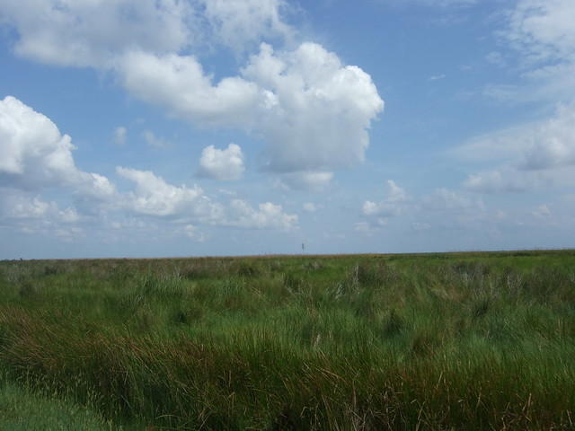
 In the interest of time and disorientation, we ended up going over at a place with no marsh.  oh, but there is so much potential planting area there.  The marsh at burke st was planted during a couple of days in 2007 and 2008.  how much more marsh could we plant in a month of work?  Coastal Restoration has to come out of our imaginations and into reality.


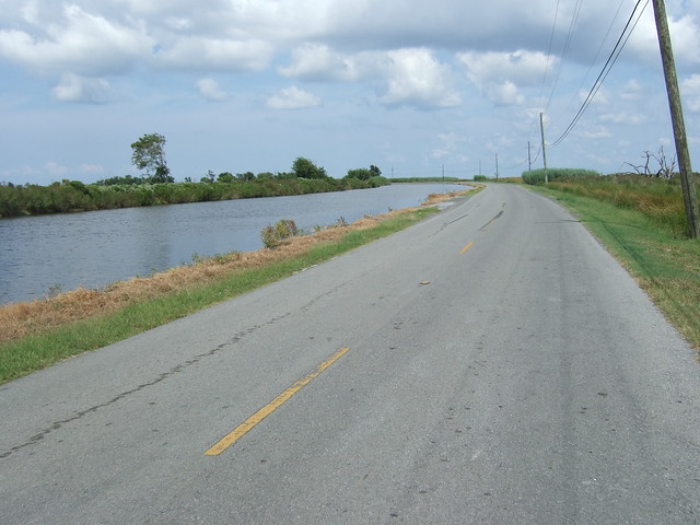
 We left the levee at twilight, and took the haynes ave bridges in the dark.  We couldn't go morrison road, because of construction, so that added a bridge to the route.   We had one dude on a clunker throw a chain---his wheel was seriously out of true, but cory was there to help take his brake off.

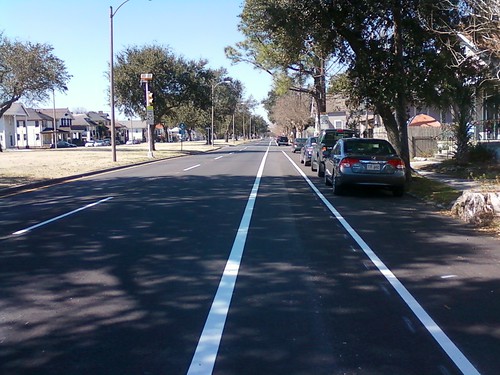
We also had a detour onto Press instead of franklin, but because they've redone pontchartrain park, it was unexpectedly nice--Press runs into gentilly, and we took that new bike lane to franklin from there.  That might be a shortcut, but i doubt it because press is curvy, and curvy the other way, away from our target of getting back downtown.    We could have also scooted over to Alvar or Louisa, but these routes are either heavily trafficked or shoddily paved.

Sorry about the confusion about the Franklin overpass.  you can access it from underneath the bridge, i think that's what people might have been doing?  But it's a great route from the river to the lake.

thanks cory for running the support crew the whole time.   If anyone has any photos, please send them to
criticalmassnolainfo@gmail.com

1) If you are interested in passing out flyers, please email me and i will send you the slips.

2) We also have business cards!  great for slipping under people's brake cable housings!  i laid out $5 for them.  So if anyone wants to buy me a snoball...

3) I think we have run out of spoke cards, so if anyone wants to step up and make new ones, they are about $10 to run off.

See you next week!

scott

Monday, July 26, 2010

Mudslide into the Wetlands: Critical Mass Friday July 30th, 6pm Jackson Square

join us for the ride of your lives!
http://www.facebook.com/group.php?gid=2263490258&v=app_2344061033&ref=ts#!/event.php?eid=139155372763892&index=1


It's over right? the well is capped (almost), and we can just do back to thinking nothing ever happened, right?

The reality is the oil and the nightmare of coastal land loss is still among us, although more people across the nation and the world have awoken to our nightmare. Even in the city, we erect levees around our homes, levees that we think will keep the water out because they keep us from seeing it. The marshes that protect us have been threatened
ever more by this giant slick, these marshes that will continue to protect and feed us so long as they exist.

The truth is that we should have marshes right in our backyards--and in some places, we still do. Join us as we ride to New Orleans East, over hell and high water, to the closest marsh to town, on the south shore of Lake Pontchartrain.

20 miles, 2.5 hours. There will be some bridges, so come get high with us (And bring your bathing suit).

To make this ride more excellent, we need some additional help:
flyering --If you are willing to pass out flyers, please email me your
name and neighborhood, and I will email you the loop strips to print
out.

support --we also need a support car this time, so email me if you are
interested.

photography / video --if you are willing and able to shoot cyclists,
email me and let's talk about where you can set up.

Don't forget: there's another demonstration 31st July in Jackson Square, 2pm
Let's keep the pressure up, let's meet each other and work on our long -term oil problems.
http://www.facebook.com/event.php?eid=118253664889769
New Orleans Worldwide BP Protest Day - July 31, 2010 2pm


see you friday!